Roderick Murchison(WP- link will open in a new tab, and give you the Wikipedia entry for Murchison), Scottish geologist, (1792- 1871), was a man who could see what he was looking at... and think new thoughts.
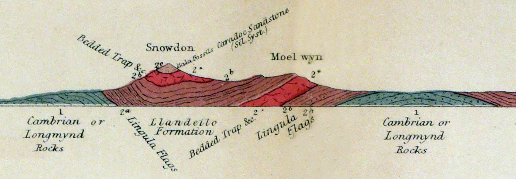
This page is a mere stub at this time, but I wanted to celebrate the geological map he published with is massive work, The Silurian System. His book was first published in 1839. The map was certainly present in the fourth edition, 1867. The map shows the rocks of Wales. The following is a small detail, from the bottom edge of the map....
Geological mapping was in its infancy. The great pioneer, William Smith (WP), published his map of the geology of England in 1815, although his first sketch for that was done 14 years earlier, and he had created a geological map of the area around Bath in 1799.
Brenda Maddox has written a wonderfully readable book, Reading the Rocks: How Victorian Geologists Discovered the Secret of Life (Goodreads reviews) about how our understanding of the world around us leapt forward in the 1800s. Murchison's story is covered in that. (It is not a book that is just for geeks!)
Murchison went further. He continued the science of determining the rocks on the earth's surface, and guessing at how things were arranged underground. (Mine shafts helped in this.)
But he also looked at fossils in the rocks. Some were simple, some were complex, and there were grades in between.
Look again at Murchison's diagram, above. If you were to walk across the land, starting at the right of the diagram, moving to the left, if the diagram is correct, you start on a bit of the Lingula Flags. You then cross a stretch of Cambrian rocks, and then reach more Lingula Flags. You haven't walked "up" or "down", but, if you accept the diagram, you were on "lower" rocks when you were on the Cambrians. Easy enough for us to grasp, today... but if you think about it, I hope you will admire Murchison for understanding that the Cambrian rocks were "under" the Lingula Flags.
Continue your walk to the left. When, as you start to clime Moel Wyn, you get to the Bedded Trap, I think any normal person would think of that bit of Lingula Flags as being "under" the Bedded Trap. It doesn't have to hard all the time!
As Murchison looked at the rocks, and the fossils in them, he noticed that The "deeper" rocks held the simpler fossils. All of this was a long time before Darwin, remember. People weren't entirely happy to admit that the landforms changed over the years, let alone that plants and animals might have evolved. Perhaps it seems to us a small step from "lower" rocks to "lower rocks are OLDER rocks"... but I don't see why that would be obvious to someone in the early 1800s... especially when you consider that for many people, the Bible (including Genesis) was simple, literal "truth". Yes- Muchison and Charles Darwin knew one another, would have discussed these things.
So hats off to Murchison?
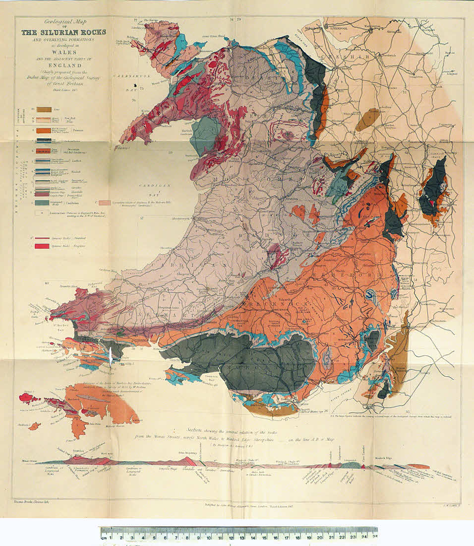
Here you can see the whole map... which is more attractive thank my failed imaging's color balance might suggest. That's a 25cm ruler along the bottom of the image.
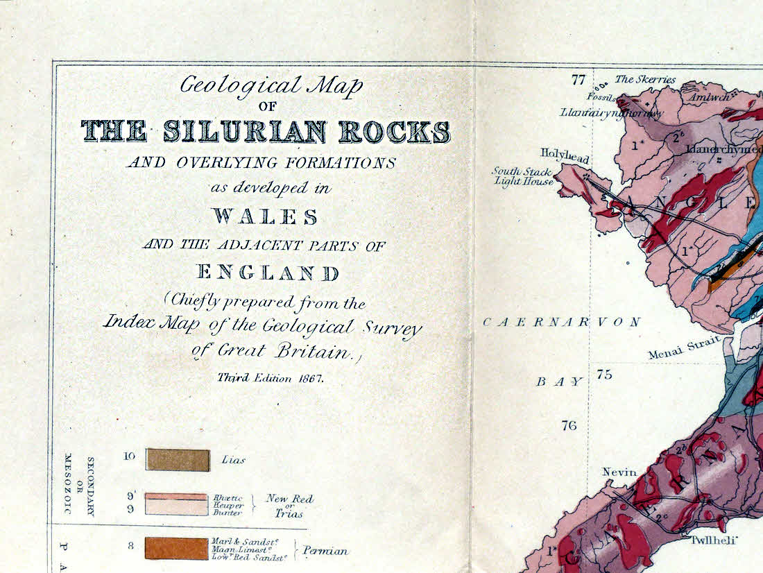
And lastly, the map's legend, if that's the right term. Note the gorgeous engraving of the letters.
Want to look closely at some image? To zoom in on just bits of it? I explain how, and give some other browsing tips on the linked page.
- - - P A G E ___ E N D S - - -